| KOENIGSBERG - SOLDIN MAP |
This map shows the area around Koenigsberg (Chojna) and the roads to
Soldin
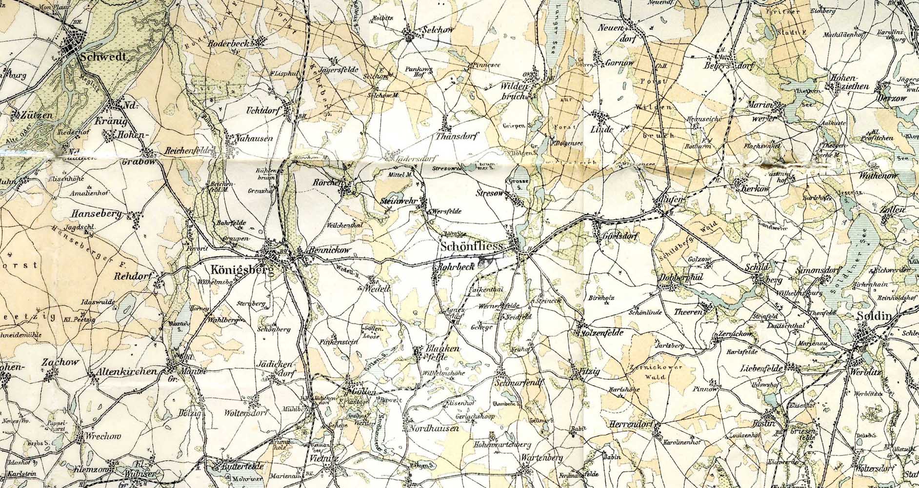
Click on map to see very large image. It may take some time
to load if you have a dial-up connection.
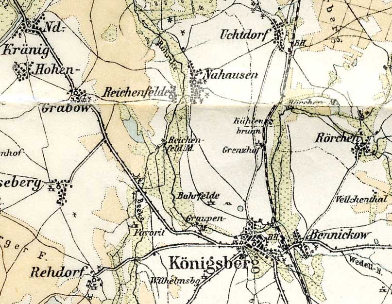
Close-up of Koenigsberg - Nahausen area, showing dwellings, mills, churches, etc.
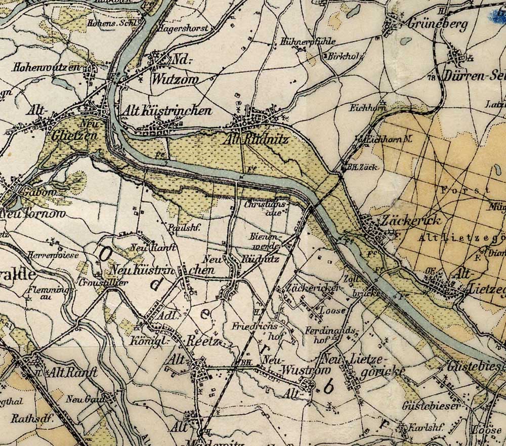
Close-up of Alt Küstrichen, Alt Rüdnitz, Zäckerick, Grüneberg and other villages.
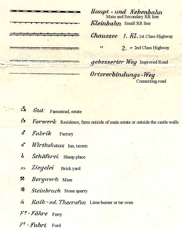
Key to the symbols on the map
Back to Nahausen Map Page
Layout & HTML coding © 2005 MJH
![]()
![]()